


Table of Content
Geofencing, a technology that creates a virtual geographic boundary, has a history that predates its widespread use in mobile applications, but its integration with smartphones truly propelled it into the mainstream.
The concept of defining and monitoring activity within a geographical area originated in the early 1990s. American inventor Michael Dimino patented geofencing technology in 1995, initially leveraging early GPS and GSM technologies for tracking and remote location. Early applications were primarily focused on practical, non-consumer uses—fleet management, asset tracking, and vehicle security within predefined zones. Public-safety agencies also adopted geofences to monitor parolees or keep vulnerable populations (for example, Alzheimer’s patients) from wandering outside safe areas.
The foundation for geofencing mobile in a broader context was laid with Location-Based Services (LBS). From roughly 2000 to 2007, early LBS on feature phones used cellular-triangulation (“cell-ID positioning”) to power simple services—“find the nearest ATM” via SMS or WAP—and planted the seed for reactive, location-aware experiences.
The key moment for geofencing in mobile applications arrived in 2007, when GPS-enabled smartphones like the original iPhone (and soon after, Android devices) put powerful processors, built-in GPS, and constant internet connectivity into everyone’s pocket. App ecosystems exploded, and developers could finally build polished, on-device geofences without purpose-built hardware.
Apple’s Core Location framework made a significant advance around 2011 with iOS 4/5, adding Region Monitoring to let apps register circular geofences and receive enter/exit callbacks even when suspended. Android responded in 2012–13 with its own Geofencing API in Google Play Services, abstracting away the polling logic and making boundary triggers both reliable and power-efficient.
By the mid-2010s, geofencing use cases flourished. Apple’s Reminders app popularized location-based alerts—“remind me when I leave work”—while retailers experimented with in-store coupons and flash-sale notifications as shoppers walked in. Task-automation platforms like IFTTT let users tie geofences to smart-home routines (“If I enter home, turn on the lights”), and social apps prompted check-ins or friend suggestions based on where you were in the world.
Early implementations were notorious for battery drain—constant GPS polling sapped power and struggled indoors. With iOS 7 (2013+) and Android’s fused-sensor enhancements, devices began sleeping until a true boundary crossing occurred, mixing GPS, Wi-Fi, and cellular data for smarter wake-ups. Then, in 2014, Bluetooth Low Energy beacons arrived: Apple’s iBeacon and Google’s Eddystone let small, battery-friendly transmitters broadcast unique IDs, enabling room-level proximity triggers and indoor wayfinding where GPS couldn’t reach.
Geofencing Mobile–Key Milestones
- 1995: First geofencing patent (Michael Dimino)
- 2007: GPS-enabled smartphones launch (iPhone)
- 2011: iOS Region Monitoring in Core Location (iOS 4/5)
- 2012–13: Android Geofencing API in Play Services
- 2013-14: Apple iBeacon spec released, popularizing BLE beacons
- 2015: Google Eddystone beacon format launched
- 2019: Apple introduces U1 chip with Ultra-Wideband (UWB) in iPhone 11 for precise ranging.
- 2019-2020: Major OS updates (iOS 13/14, Android 10/11) significantly enhance user location privacy controls.
- 2021: Android 12 adds official UWB support and API.
- 2018+: Advancements in AR location anchors (ARKit/ARCore) enable richer geofenced AR experiences.
- Increasing use of AI/ML for predictive and context-aware geofencing; emphasis on on-device processing for privacy.
Despite its power, geofencing has faced challenges—early battery drain and indoor accuracy issues, privacy and permission concerns (GDPR, CCPA), and notification fatigue when apps over-notify. Yet the technology has persisted, evolving to monitor dwell time, fuse multiple location sources, and surface ever more personalized, context-aware interactions.
Geofencing Apps: Current Power & Future Frontiers
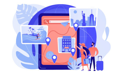
Geofencing apps are a fundamental building block in retail, logistics, gaming, social networking, security, and smart-home systems. A prime example in the smart home is the use of geofencing in smart locks, allowing for automated unlocking upon arrival or locking when leaving a predefined area.
Similarly, in logistics and retail, its role in real-time inventory tracking and management is crucial for monitoring assets as they move through warehouses and distribution networks.
Looking ahead, expect AI/ML-driven triggers that learn routines, Ultra-Wideband (UWB) for sub-meter accuracy, augmented-reality zones that unlock location-based experiences, and on-device geoprocessing to keep user data private.
Ready to build your own geofencing app?
Explore our blog post: Build a Geofencing App with Krasamo